
Reviewed · SELF-GUIDED TOURS
Highway 1 Pacific Coast Highway Self-Guided Driving Tour Bundle
The best thing about this Highway 1 audio tour is the freedom. You get the famous Pacific coast drive without a bus schedule or guide in the passenger seat, while stories about lighthouses, elephant seals, surf towns, bridges, and local history play along the route. I especially like the offline GPS and the fact that one purchase covers a car of up to four people.
I also like the year-long validity. You can split the drive across several days, repeat sections, or use the tour on a return trip. The catch is that navigation may not be as clear as you expect, and the audio can start late or cut off, so you should download everything before leaving and keep the app open.
In This Review
- Key details before you drive
- What this Highway 1 tour really gives you
- San Francisco to Half Moon Bay: a gentle start
- Pigeon Point to Santa Cruz: lighthouses, beaches, and odd attractions
- Monterey and Carmel: allow time beyond the audio
- Big Sur: the strongest part of the drive
- Cambria to San Luis Obispo: slower towns and strange roadside stops
- Guadalupe to Santa Barbara: dunes, flowers, and Spanish California
- Ventura to Santa Monica: the final Southern California stretch
- Price, app setup, and the main weakness
- Who should book this Highway 1 experience?
- Should you book it?
- FAQ
- How long does the Highway 1 self-guided tour take?
- Where does the tour start and end?
- Does the tour work without cell service?
- Is the price per person?
- Are attraction tickets and park fees included?
- How long can I use the tour after buying it?
Key details before you drive
- A 555-mile coastal route: The tour runs from San Francisco to Santa Monica, passing through Big Sur, Monterey, Santa Barbara, Malibu, and many smaller coastal towns.
- One price per car: At $29.99 for up to four people, the cost is modest compared with a private guide or group tour.
- Offline GPS audio: Download the Action’s Tour Guide app and route while you have strong Wi-Fi or cellular service. Stories should trigger as you reach each point.
- Built for flexible stops: Pause for lunch, hikes, photos, beaches, or overnight stays, then continue when you are ready.
- Bring your own admission money: Park fees, attraction tickets, reservations, and entry passes are not included.
- Navigation needs attention: Follow the marked route, start at the designated point, obey speed limits, and do not rely on the audio alone for every turn.
What this Highway 1 tour really gives you
This is not a traditional guided excursion with a driver, pickup service, or live host. It is a private, self-guided driving experience delivered through your phone. You begin near Lakeshore in San Francisco and finish at Santa Monica Pier, with the route designed to connect the major sights along California’s coast.
The narrator’s name is not provided, but the app is built around a polished voice and location-triggered storytelling. The goal is to explain what you are seeing as you drive, rather than make you stop at every point. That matters on Highway 1, where the road itself is part of the experience and many sights appear quickly from the car.
The advertised driving portion is about five to seven hours, while the full experience is often described as 10 to 11 hours. Those figures make sense only if you separate moving time from stopping time. A nonstop run is already a long day, and beaches, towns, hikes, whale-viewing points, meals, and side trips can stretch the journey well beyond one day.
I would treat this as a multi-day route, not a single marathon drive. The app remains valid for one year, so there is no reason to rush past Big Sur or skip Monterey just to reach Santa Monica by evening.
More self-guided routes in San Francisco:
- San Francisco: Alcatraz Ticket, Ferry, & Self-Guided App
★ 4.5 · 2,460 reviews - San Francisco: Alcatraz, Ferry & Audio Tour w/ Night Option
★ 4.4 · 617 reviews - Official Alcatraz Island Prison Tour with Free App Audio Packages
★ 4.5 · 337 reviews
San Francisco to Half Moon Bay: a gentle start
The first section introduces you to the coast just outside San Francisco. In Pacifica, the narration covers San Francisco Bay, Spanish explorer Gaspar de Portolá, and the unusual story behind the town’s name. It is a useful opening because it gives context to a stretch of coast that can otherwise feel like a string of overlooks.
Pedro Point is a rocky coastal stop with strong ocean views. The old road to the point is no longer open to cars, and access is by footpath at low tide, so this is a place to approach with care rather than assume you can simply pull up and walk a few yards.
At Devil’s Slide Trail, you learn about a World War II bunker built to watch for a possible Japanese invasion. The bunker’s later life as a hangout for local youths and graffiti artists adds a less polished, more human detail to the stop. Admission is not included here, and the short suggested visit does not include time for a serious hike.
Gray Whale Cove State Beach can be rewarding in December and January, when migrating gray whales may pass close to shore. Wildlife sightings are never guaranteed, but the timing note is useful. Montara follows with an old lighthouse town feel and older buildings that give the place a distinct character.
The route then reaches a beach known for very large surf, with waves that can reach 60 feet during peak conditions. This is mainly a viewing stop unless you are an experienced surfer. Half Moon Bay adds a quieter town break, along with a darker story about corruption and mob activity in the area.
Pigeon Point to Santa Cruz: lighthouses, beaches, and odd attractions
Pigeon Point Lighthouse is one of the most photogenic stops on the northern route. At 115 feet, it is the tallest lighthouse on the west coast and among the oldest. Give yourself more time than the suggested five minutes if you want photos or a proper look around.
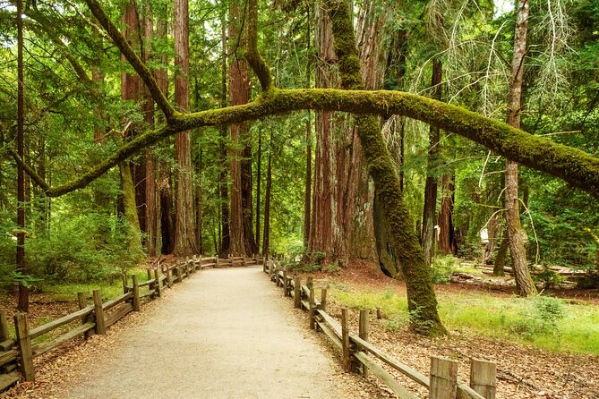
The road passes several redwood areas, including Henry Cowell Redwoods State Park and Big Basin Redwoods State Park. You may not enter either one on the main route, but the audio helps explain what you are passing. Big Basin is especially associated with old-growth trees, a thick canopy, and possible morning wildlife sightings.
Elephant seals appear later along the route, but the first major coastal section is already a good reminder that Highway 1 is not only about viewpoints. Depending on the season and exact stop, you may see wildlife, historic structures, or geological features without paying for a formal attraction.
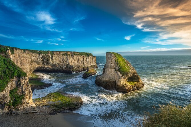
Davenport is a small town with beaches and the Davenport Crack, a deep tunnel carved through a cliff by water. Shark Fin Cove gets its name from a rock formation that resembles a shark fin, not from any special danger in the water. Pocket beaches offer more secluded shore access, but getting down to them can require some scrambling.
Santa Cruz is one of the larger and livelier stops. You can break for food, browse shops, walk the wharf, or visit the amusement park and its wooden roller coaster. The audio also covers the Mystery Spot, a long-running attraction with demonstrations that appear to defy gravity.
This is a section where the tour’s short suggested stop times may not fit your interests. Santa Cruz alone can fill several hours, especially if you add the wharf, the Mystery Spot, and a beach visit.
Monterey and Carmel: allow time beyond the audio
Monterey’s story is tied to the sardine-packing industry, and Cannery Row now occupies former factory buildings with restaurants, shops, and bars. The city is also home to the Monterey Bay Aquarium, which requires its own admission ticket and planning. The tour can tell you why the area matters, but it does not replace a full aquarium visit or a walk through town.
The route includes information about the bay’s once-abundant sardines and what changed that industry. This kind of background is where a self-guided audio tour earns its keep. You see a modern coastal city, then understand the industrial past beneath it.
Carmel-by-the-Sea is smaller, prettier, and more storybook-like, with fairytale cottages, art galleries, and an unusual cast of residents. Carmel Beach, beside a cypress grove, is a natural place to stop for a walk, dog watching, surfing, or sunset.
The famous 17-Mile Drive is included as a scenic detour with views toward Pebble Beach and Pacific Grove. The main Highway 1 tour only covers selected highlights, so do not assume the audio offers a full guide to every part of 17-Mile Drive. A separate tour is better suited if you plan to spend serious time on that detour.
A few more San Francisco tours worth comparing
- Muir Woods and Sausalito (Return by Bus or Ferry)
★ 4.5 · 5,098 reviews - Big Bus SF: Hop-on Hop-off Tour with 17 Stops and Sunset Option
★ 4.0 · 4,539 reviews - Napa and Sonoma Wine Country Full-Day Tour from San Francisco
★ 4.5 · 4,455 reviews - Small Group Yosemite and Giant Sequoias Day Trip from San Francisco
★ 5.0 · 3,671 reviews
Big Sur: the strongest part of the drive
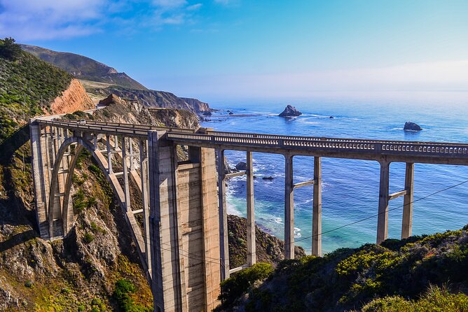
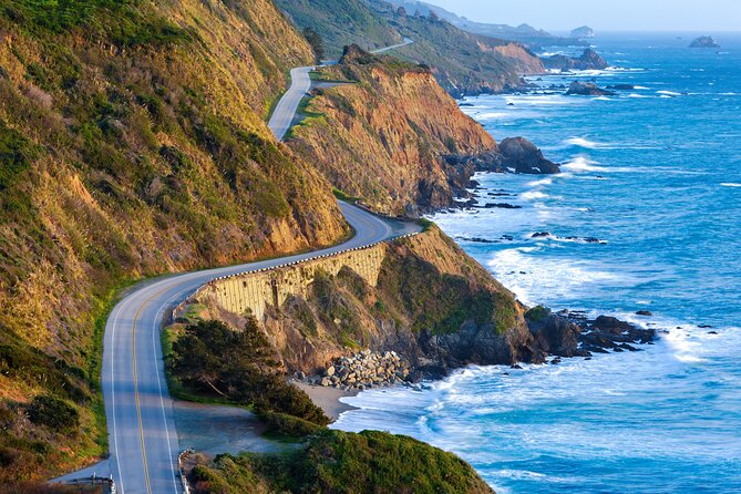
Big Sur is the section most people picture when they think of the Pacific Coast Highway. The road follows high bluffs above crashing water, with green slopes, rocky trails, bridges, and long views. Here, I would slow down and plan your stops before you begin, because many turnouts are small and the best viewpoints can pass in seconds.
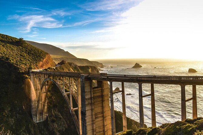
Garrapata State Park offers trails toward the coast, through valleys of lilies, and into redwood areas. Park admission is not included. Bixby Creek Bridge is free to view and one of the most photographed structures on the route, thanks to its concrete arch and dramatic setting.
Point Sur Lighthouse marks a rocky island that once threatened ships at night. The area around it remains striking, while the lighthouse adds a story about how navigation changed along this coast. Other stops explain protected stretches of shoreline, a newer bridge built after a 2017 landslide damaged its predecessor, and the route’s ongoing battle with rockslides.
Pfeiffer Beach requires a detour down a narrow road, but it is famous for purple sand caused by manganese garnet from the nearby bluffs. That unusual detail makes it one of the more memorable optional stops. A modest dirt lot also offers one of the best Big Sur views, proving that the grandest scenery does not always require a formal attraction.
Partington Cove is a sheltered spot with a short walk and a story tied to suspected Prohibition-era moonshiners. Admission is not included. McWay Falls, an 80-foot waterfall altered by mudslides, is another major sight, though its present shape reflects the changing coast as much as the original cascade.
Big Creek Bridge, the Pitkins Curve Bridge, Limekiln State Park, and several overlooks keep the route interesting. Limekiln adds historic lime kilns and hiking. Jade Cove offers the chance to search for small pieces of jade, though the larger finds are long gone.
Ragged Point is one of the finest stretches for views, with bluffs rising as high as 400 feet and little development. The nearby rustic inn is useful for a meal or break, even if you are not staying there. Further south, Elephant Seal Vista Point provides an accessible walkway and a very strong chance of seeing large groups of elephant seals on the shore, especially from December through April.
Cambria to San Luis Obispo: slower towns and strange roadside stops
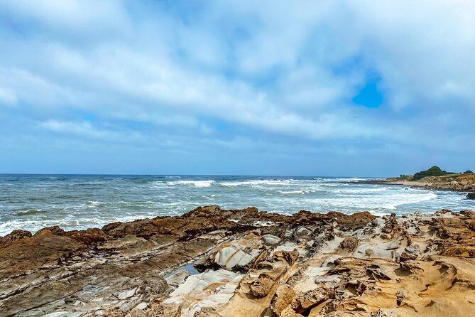
Moonstone Beach Drive provides a pleasant break from the car. Its boardwalk runs along the shore and is well suited to a short walk. Nearby Nitt Witt Ridge is one of the route’s strangest sights, a house assembled largely from discarded materials by artist Arthur Beal.
Harmony is tiny, with only 18 residents at the last census count provided for the tour. Cayucos has a more old-fashioned feel, with saloons, antique shops, and reminders of its 1867 founding. These towns are useful counterpoints to Monterey and Santa Barbara. They show you a quieter side of the coast.
Morro Bay is marked by Morro Rock, a 600-foot volcanic plug that serves as a nesting place for peregrine falcons. San Luis Obispo, known locally as SLO Cal, offers restaurants, greenery, flowers, and a pleasant small-city stop. Bubblegum Alley is exactly what its name suggests, two walls covered in gum from years of visitors.
A former mining area now provides more than eight miles of hiking and mountain biking trails. Avila Beach adds a difficult story about an oil company destroying the town and the later rebuilding effort. Dinosaur Caves Park has no actual dinosaurs or caves, but it is suited to a picnic and a stretch of the legs.
Pismo Beach has both early missionary history and a famous monarch butterfly grove. From October through February, around 25,000 monarchs may shelter in the eucalyptus trees. That seasonal detail is worth planning around, since the grove is far more important during the winter months.
Guadalupe to Santa Barbara: dunes, flowers, and Spanish California
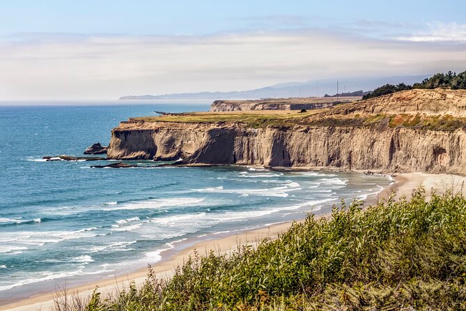
Guadalupe is a practical small-town break before the route turns toward larger coastal destinations. Nearby dunes reach as high as 500 feet, making them the tallest on the west coast according to the tour narration. The views from the top can be impressive, but this is not a quick roadside photo stop if you plan to climb.
Lompoc is known for flower growing and murals. Forty murals around town depict local history and the flower industry. The Lompoc Wine Ghetto looks plain from outside but contains wineries and tasting rooms inside, giving you a low-key place to sample local wine.
Jalama Beach is an optional detour for a quieter shoreline. It takes extra time, but it may suit you better than the more crowded beaches farther south. Refugio State Beach offers white sand, palms, bright water, and a classic Southern California feel.
Another butterfly grove appears along this section, though the eucalyptus trees have struggled and may support fewer butterflies. If you are visiting between November and February, it is still worth considering, but keep expectations realistic.
Santa Barbara is one of the most polished stops on the route, with Spanish mission roots, art galleries, restaurants, and beaches. The audio gives you an introduction, but I would not limit your visit to five minutes. A town this attractive deserves a meal or an evening.
Thousand Steps Beach is reached by 218 steps, not 1,000, but the climb back up can still be tiring. Carpinteria State Beach is good for swimming and camping and may offer harbor seal sightings. Rincon Beach and Faria Beach are better known for surfing than broad sandy recreation, with Faria offering limited sand space and more privacy for local surfers.
Ventura to Santa Monica: the final Southern California stretch
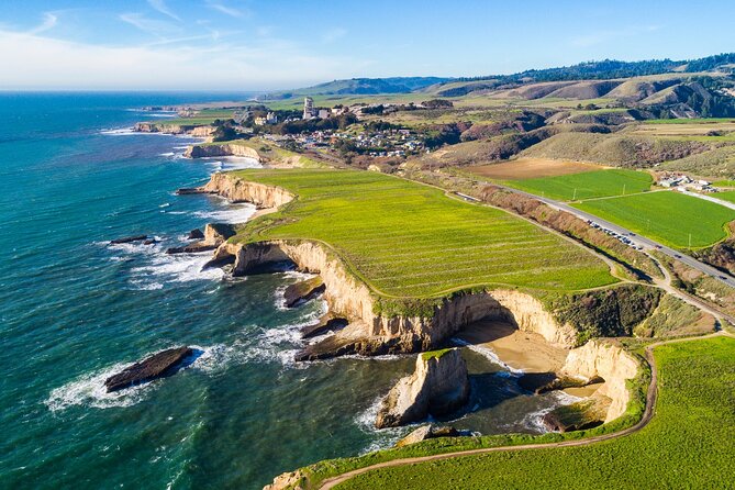
Ventura brings a seaside boardwalk, restaurants, boutiques, and a history that includes famous names such as Johnny Cash and John Lennon. Point Mugu Rock is an old volcanic formation that challenged the engineers who built Highway 1. Sycamore Cove Beach adds camping, picnic tables, and public grills.
El Matador State Beach is a strong photography stop, especially near sunset, when its unusual rock formations catch the light. Point Dume and Zuma Beach are popular Los Angeles-area beach escapes, and Point Dume also appeared in the famous Planet of the Apes scene with the ruined Statue of Liberty.
Malibu is the expected finale before Los Angeles, with surfing, beaches, celebrity homes, and the relaxed feel of a Southern California coastal town. The Getty Villa is also noted near the Malibu coast, but entry is not part of this purchase.
The official endpoint is Santa Monica Pier. Its beach, food, and amusement attractions make a pleasant finish, but your arrival time matters. A 10 to 11 hour day can become longer with traffic, photos, meals, and detours, so consider staying overnight rather than forcing the whole route into one sitting.
Price, app setup, and the main weakness
At $29.99 per group of up to four, this is good value if everyone shares one car. The per-car price is the key advantage. You pay once instead of buying four tickets, and the tour remains available for a full year.
The app setup deserves care. After booking, you receive instructions and a password by email and text. Search for audio tour if the message is hard to find, download the separate Action’s Tour Guide app, and download the route while you have strong service.
Once you reach the starting point, the first story should begin automatically. The route is designed to trigger stories by location, letting you listen hands-free. Connecting your phone to the car stereo will make this much easier.
The main weakness is navigation. The audio supplies route cues, but it is not a full replacement for watching the road and checking directions. One person who used the tour found it easy to leave the route because the directions were minimal. Another could not get the tour to start after being sent to a residential area through Google Maps.
I would enter the starting point manually, use the route shown inside the Action app, and confirm the direction before pulling away. Keep to the suggested speed so the narration does not get ahead of your position. Some audio segments may have gaps, start with clipped words, or give too little warning before a stop, so do not wait for the last second to decide if you want to pull over.
Who should book this Highway 1 experience?
I would recommend it to independent drivers who want background stories but do not want a fixed group itinerary. It is especially useful for couples, families, or friends sharing one car, since the price covers four people.
It suits repeat visitors, too. You can use the app on separate days, return to a favorite section, or plan a second trip within the 12-month validity period. It is also a good choice if you want to mix major stops with smaller places such as Harmony, Davenport, Cayucos, or Lompoc.
I would be cautious if you want exact turn-by-turn navigation, a live guide, or a tightly managed schedule. The app’s strengths are context and flexibility, not flawless routing. You should also budget separately for parks, museums, the Monterey Bay Aquarium, 17-Mile Drive, parking where required, food, and any paid attractions.
Free cancellation is available up to 24 hours before the scheduled start time. Within 24 hours, the price is not refunded.
Should you book it?
Book this tour if you value freedom, can manage your own navigation, and plan to split Highway 1 into sensible sections. The offline audio, year-long access, and $29.99 per-car price make it a practical companion for a self-guided road trip.
Skip it if you need a guide who will point out every turn, announce stops well in advance, and solve technical problems for you. For the best result, download early, test the app, connect it to your car stereo, start at the correct point, and keep a normal map available as backup.
FAQ
How long does the Highway 1 self-guided tour take?
The route is described as about 10 to 11 hours overall, while the actual driving portion is listed as roughly five to seven hours. Stops, meals, hikes, photos, traffic, and detours can make the trip much longer.
Where does the tour start and end?
The starting point is near Lakeshore in San Francisco. The tour ends at Santa Monica Pier in Santa Monica.
Does the tour work without cell service?
Yes. You must download the tour while connected to strong Wi-Fi or cellular service. After that, the GPS audio and maps are designed to work offline.
Is the price per person?
No. The $29.99 price covers one group of up to four people in a car.
Are attraction tickets and park fees included?
No. Entry tickets, attraction passes, reservations, and admission fees are not included.
How long can I use the tour after buying it?
The downloaded tour is valid for one year, so you can use it for an extended visit, separate driving days, or a return trip during that period.
Recently added around San Francisco
- Guided Private Wine Tour to Napa and Sonoma Wine Country★ 5.0 · 3 reviews
- San Francisco: Muir Woods Giant Redwoods & City Private Tour★ 5.0 · 3 reviews
- Napa or Sonoma Private Wine Tour from San Francisco★ 5.0 · 3 reviews
- San Francisco Chinatown Food and Culture Tour★ 5.0 · 3 reviews
- San Francisco City Half-Day Private Custom Tour★ 5.0 · 3 reviews
- SFO Pick-Up with City Sightseeing Tour★ 5.0 · 3 reviews
- 6-Hour Luxury Napa Wine Tasting Tour with Route Planning★ 5.0 · 3 reviews
- Muir Woods, Sausalito and Ferry back to Fisherman’s Wharf★ 4.7 · 3 reviews
Self-Guided Tours, compared.
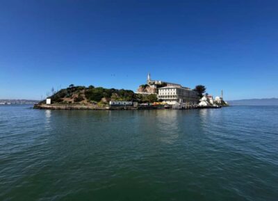
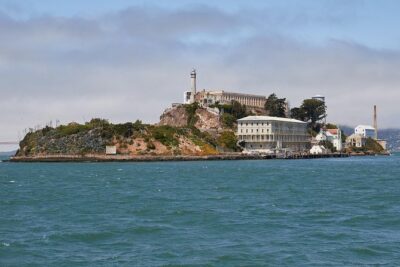
Official Alcatraz Island Prison Tour with Free App Audio Packages
Read our review →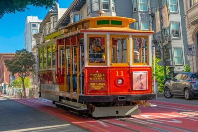
Self-Guided Cable Car City Tour in San Francisco
Read our review →
Alcatraz Inside Access Ferry and Audio Tour with Night Option
Read our review →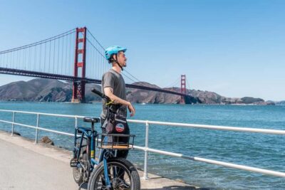
Golden Gate Bridge to Sausalito Self-Guided Bike Tour
Read our review →
Browse the lists this tour appears in